
Hartford ZIP Codes Are Postal Geography
ZIP Code is a delivery key created for mail routing. USPS offers three useful modes: search by address, search by city and state, and find cities by ZIP. The Secretary of the State’s post-office list identifies Hartford main and station labels, including Hartford Main Office, Hartford Station, Unity Plaza, and Blue Hills Station. These labels help explain the postal system, but they are not parcel boundaries or population counts.
The table separates likely physical-city delivery ZIPs from special-use and routing groups. Use USPS by Address for an individual street. Do not assign every record carrying “Hartford” to the same neighborhood or assume every 061xx code is normal household delivery.
| ZIP | Areas covered | Post office | Notes |
|---|---|---|---|
| 06101 | Main Hartford postal and central downtown area | Hartford Main Office | Central or special-use mix; verify by address |
| 06102 | Hartford PO or unique delivery use | Hartford 06101 label | Not a simple residential polygon |
| 06103 | Downtown and central Hartford station geography | Hartford Station | Civic and office addresses occur here |
| 06105 | West End and western Hartford test area | Hartford postal city | Check exact street edges |
| 06106 | Frog Hollow, South Green, Southwest and nearby central/southwest areas | Hartford Station 06106 | Neighborhood edges do not equal ZIP edges |
| 06112 | Blue Hills and northern Hartford test area | Blue Hills Station | Use address lookup for the east boundary |
| 06114 | South End, Barry Square, and south Hartford test area | Hartford postal label | Wethersfield routing can confuse results |
| 06120 | North Meadows, north Hartford, and Unity Plaza area | Unity Plaza | Check the physical parcel |
| 06123 | Unique, PO-box, or institutional Hartford group | Hartford 06101 label | Not a neighborhood ZIP |
| 06126 | Unique or institutional Hartford group | Hartford 06106 label | Verify the street or facility |
| 06141-06147 | Unique, PO-box, or institutional uses | Hartford 06101 label | Do not infer a household area |
| 06150-06156 | Large-volume or institutional uses | Hartford 06101 label | Routing group, not a resident count |
| 06160, 06176, 06180, 06183, 06199 | PO-box or special-use Hartford group | Hartford 06101 label | Confirm individual delivery address |
These categories come from the postal and state routing material in the Hartford research. No official per-ZIP population or voter table was located, so a ZIP directory should not invent one.
Hartford ZIP Directory: Find Residents
For a physical Hartford street, the practical first tests are 06103, 06105, 06106, 06112, 06114, and 06120. Those labels often align with central, west, north, south, or station delivery areas, but the edges must be tested address by address. Downtown Hartford has a high share of civic, courthouse, state, office, and institutional records. A name connected to a downtown ZIP may be an organization or public building rather than a household.
Use the ZIP as a filter after the street is normalized. Compare a USPS return with Hartford GIS Address Points, the parcel situs, the owner mailing field, and a static neighborhood or voting map. If the ZIP disagrees with the city or neighborhood name, do not “correct” one source by guessing. Record both and ask the relevant custodian which field controls the question.
A ZIP directory is strongest when it states what the code can narrow and what it cannot establish. Postal labels are clues to delivery, not evidence of occupancy.
Hartford ZIP Stations and Labels
Connecticut’s Secretary of the State post-office list gives a useful local vocabulary: Hartford main office 06101, Hartford station 06103 and 06106, Unity Plaza 06120, and Blue Hills Station 06112. A station label explains routing. It does not draw the neighborhood line shown on a Hartford NRZ, census, zoning, or parcel map.
Unique and PO-box codes are especially easy to misread. A person or organization may use one for correspondence while the physical location belongs to a different street or town. The same Hartford routing group can include 06102, 06123, 06126, 06141-06147, and other special-use codes. Search the complete address when the question is about a person, building, or parcel.
For mail, keep the USPS result. For land, keep the Hartford situs and parcel. For an old household, keep the printed street and year because historical directories do not use modern ZIP keys.
Verify a Hartford ZIP by Address
The USPS lookup is the final normalization step for a mailing address. Enter the company or person line only when needed, then street address, apartment or suite, city, state, and ZIP. The returned delivery label can be compared with Hartford’s parcel situs and the owner’s mailing ZIP. USPS itself warns that a ZIP result does not confirm that a person or company is at an address.
- Write the address exactly as known, including direction, suffix, unit, and city.
- Run the USPS address mode, then save the standardized city and ZIP.
- Search the Hartford Property Viewer by address and compare situs, parcel, and mailing fields.
- Check the Hartford static map for neighborhood, street, voting, census, or NRZ context.
- If a town line or special-use code appears, ask USPS or the city custodian which question the field answers.
The Hartford map catalog is a useful comparison layer. Open Hartford GIS static maps for street, neighborhood, voting, tax, NRZ, zoning, and census context.
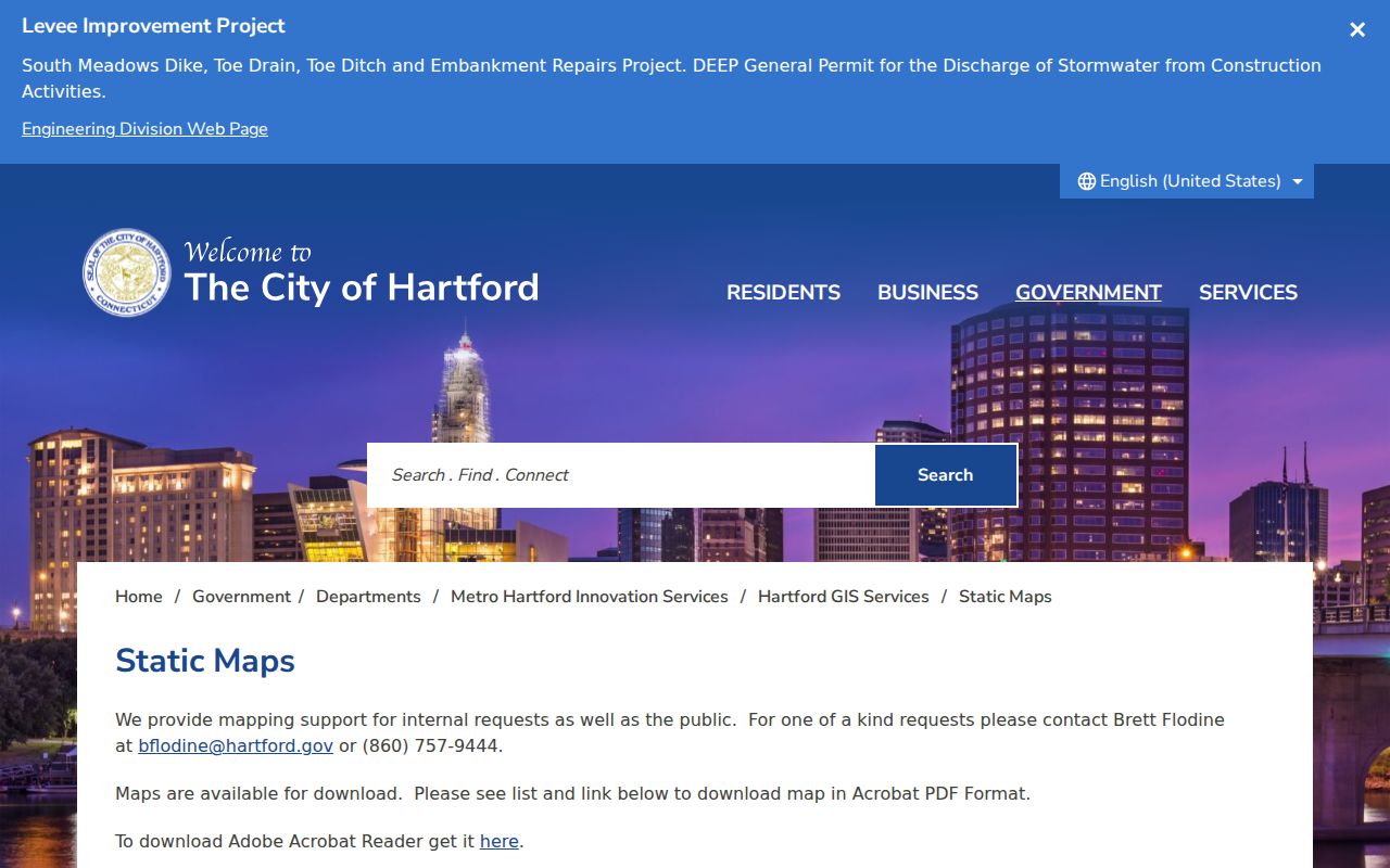
The map is a civic comparison, not a USPS delivery boundary. Preserve the postal result and the municipal layer as separate evidence.
Hartford ZIPs Are Not Neighborhoods
Hartford’s neighborhoods, NRZs, census tracts, voting districts, zoning areas, and ZIP delivery zones overlap without matching. Asylum Hill, West End, Frog Hollow, South Green, Southwest, Behind the Rocks, Upper Albany, Northeast, Blue Hills, Parkville, Barry Square, South End, and Sheldon-Charter Oak each have their own historical or planning context. A ZIP can cut through one of those areas or carry a label used for another part of the city.
Use a ZIP to narrow a list of addresses, then switch to parcels and maps for the physical relationship. The GIS static-map catalog includes tax-map, street, neighborhood, voting, NRZ, future-land-use, and 2010 census materials. A ZIP result should never replace a parcel boundary, legal description, or official municipal address.
- ZIP
- A USPS delivery geography used for sorting and address normalization.
- ZIP+4
- An extended delivery code; it is not a parcel or household identifier.
- PO-box or unique ZIP
- A special-use code for a box, institution, or high-volume receiver rather than a normal neighborhood.
- Carrier route
- A postal delivery grouping inside the routing system, not a city planning boundary.
Hartford ZIPs and City Lines
Hartford postal routing can include neighboring-town examples. The research notes 06108 as East Hartford and 06109 as Wethersfield in postal or city references, even though those codes can appear in Hartford routing group material. That is why “Hartford” in a postal label cannot settle municipal location. Connecticut has no county government, and “Hartford County” on a record is a historical, judicial, or archive label rather than a property custodian.
When a street sits near a boundary, compare the USPS result with the Hartford GIS parcel, municipal tax or planning record, and the deed’s legal description. Do not infer annexation, an enclave, or a neighborhood from a ZIP alone. The city’s address-assignment and readdressing policy was not identified as one separate public portal, so a disputed address should go to Planning, Development Services, 311, or the assessor.
One clean postal match is helpful. It is not the final answer to a city or resident question.
Which Hartford Portals Accept ZIP
ZIP fields behave differently across Hartford portals. The parcel REST layer exposes Zip10 as a mailing field, while the visible Property Viewer modes are Parcel Number, Owner Name, and Address. Accela’s address lookup exposes a ZIP field, but it filters address or permit records rather than all people. The tax page documents Name, Property Location, Bill Number, and List Number, not a confirmed ZIP browse. The voter lookup is a named-person route.
| Portal or field | What a ZIP result means |
|---|---|
| Hartford GIS REST Zip10 | Owner mailing ZIP field; not necessarily the parcel’s physical ZIP. |
| Accela address ZIP | Address or record filter; live form was blocked during inspection. |
| Hartford tax search | Name, property location, bill, or list account; no published ZIP filter. |
| Connecticut voter lookup | Named registration and polling route; no street-wide ZIP browse. |
| USPS by Address | Standardized delivery ZIP for the complete address. |
Accela’s captured address form shows the ZIP field in context. Open Hartford Accela property lookup and use it for the record mode that matches the address question.
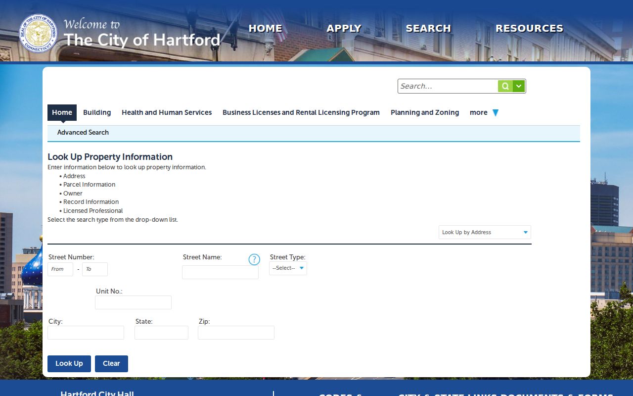
The public form returned a 403 during inspection, so labels or availability can change. Treat the screenshot as evidence that a ZIP field exists, not as a guarantee of a current result screen.
Mailing ZIP versus Hartford Situs
A Hartford parcel can carry a mailing ZIP that belongs to correspondence rather than physical land. Owner mail can go to a fiduciary, company, PO box, or out-of-town address. Conversely, a Hartford situs can carry a postal city label that looks unfamiliar because stations and routing groups do not follow a simple neighborhood map. Preserve the field name when copying a result.
For property research, use situs, parcel number, GIS PIN, LegalRef, TaxMap, and the municipal record. For mailing, use the USPS standardized address. For a person, use the voter or other name-based route with its privacy rules. For a historic household, use street and number from the printed source, not the current ZIP.
This field separation prevents a common ZIP directory error: turning an owner’s correspondence destination into a claim about where the owner or any other person lives.
Hartford ZIPs and Historical Directories
Hartford’s city directories predate ZIP codes and organize people by name, street, business, or household. Gardner’s 1840 street guide uses directions and intersections. Geer’s volumes include “h” home notation and, in some years, separate community listings. Reverse and criss-cross books arrange addresses and numbers. A modern ZIP cannot reliably retrieve a nineteenth-century entry.
Search old street names, wards, neighborhoods, East Hartford, West Hartford, and suburban supplements. Pair the printed address with a map, deed plan, census enumeration district, Sanborn sheet, or later parcel record. If a person moved across a town line, a Hartford postal label may be a weak clue while the directory’s own street and publisher coverage are stronger.
The ZIP directory should hand historical household work to the city directories collection and current address work to the by-street records. Each source has a different geography and date.
Hartford ZIP Research Gaps
The inspected sources did not provide a current USPS result for a sample address, a city-published USPS ZIP polygon, per-ZIP population table, or official street-level boundary file. USPS returned a crawler block, and the Hartford Accela form was also not available as a live result. Those are research gaps, not reasons to invent neighborhood counts or assign a ZIP to every parcel in a label group.
For a defensible ZIP note, save the date, full address, USPS return, Hartford situs and parcel, GIS map layer, and any disagreement. Ask the city or postal custodian when the question involves a line, a special-use code, or a changed address. If the ZIP only narrows the search, continue with the Hartford by-street address chain.
Final check. A ZIP code can narrow where mail goes. It cannot prove municipal ownership, a neighborhood boundary, a household, or a current resident.
That modest claim is the useful endpoint for a Hartford ZIP code directory: postal evidence kept separate from parcel, person, and history evidence.