
Finding Who Lives on Hartford Streets
Street-level research in Hartford begins with what the public record can actually support. The assessor and GIS can tie an address to a parcel, an owner field, a mailing destination, and physical characteristics. A deed index can show parties to a recorded transfer. A voter lookup can answer a named registration or polling question. A directory can show a dated occupant or business. None of those records is a complete household census, and each has a different date.
Walk from the known address outward. Keep the exact street spelling, directional, number range, unit, ZIP, and parcel ID in a small research note. That keeps a condo card, an old street label, or a mailing address from being mistaken for a second house.
- Enter the street number and name in the Hartford Property Information Viewer. Copy the parcel number, owner, situs, mailing address, LegalRef, TaxMap, and last-sale fields.
- Open HartfordGIS and pan along the street. Click adjacent polygons, compare parcel IDs, and narrow any REST query by street name instead of requesting the whole city.
- Use SearchIQS with the owner as grantee near the last-sale date. Read the deed, then search the grantor as an earlier grantee.
- Use the Connecticut voter lookup only for a named person or permitted status question. The state does not provide a public street-wide browse of every voter.
- For earlier occupants, ask the library for a reverse or criss-cross directory by year, then verify the occupant in a name-first directory, census, obituary, probate, or deed.
Hartford Street Property Viewer
The Hartford Property Information Viewer exposes three useful search modes: Parcel Number, Owner Name, and Address. Address search is the natural start for a whole street. The resulting card or popup can connect a street location to a parcel or GIS PIN, owner name, mailing address, land-use code, zoning, neighborhood, tax map, and building fields. The public card is an assessed-property record. It does not promise that the named owner lives there.
Hartford’s parcel REST layer adds fields that help a street researcher move from map to deed. OwnerFullName and the owner-name components sit beside MailingAddress1, MailingStreet, City, State, and Zip10. LastGrantor, LastSaleDate, LastSalePrice, LastSaleType, and LegalRef can launch a recorded-party search. LivingUnits, YearBuilt, gross area, acreage, value, zoning, and neighborhood fields provide property context, but they do not identify every person using a building.
The official viewer is the first visual stop for a Hartford street directory. Open the address search and preserve the parcel ID before moving to another source.
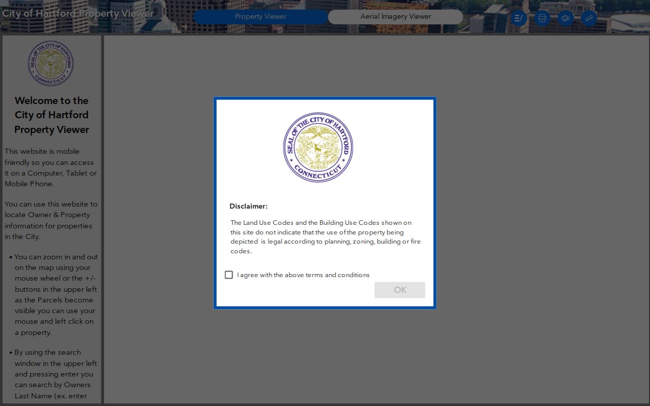
The parcel view turns a street number into a stable research key. Recheck the street name and unit on the card before comparing it with a deed or permit.
The underlying field service shows why the parcel number matters. Inspect the Hartford parcel REST layer for owner, mailing, situs, legal, sale, and building fields.
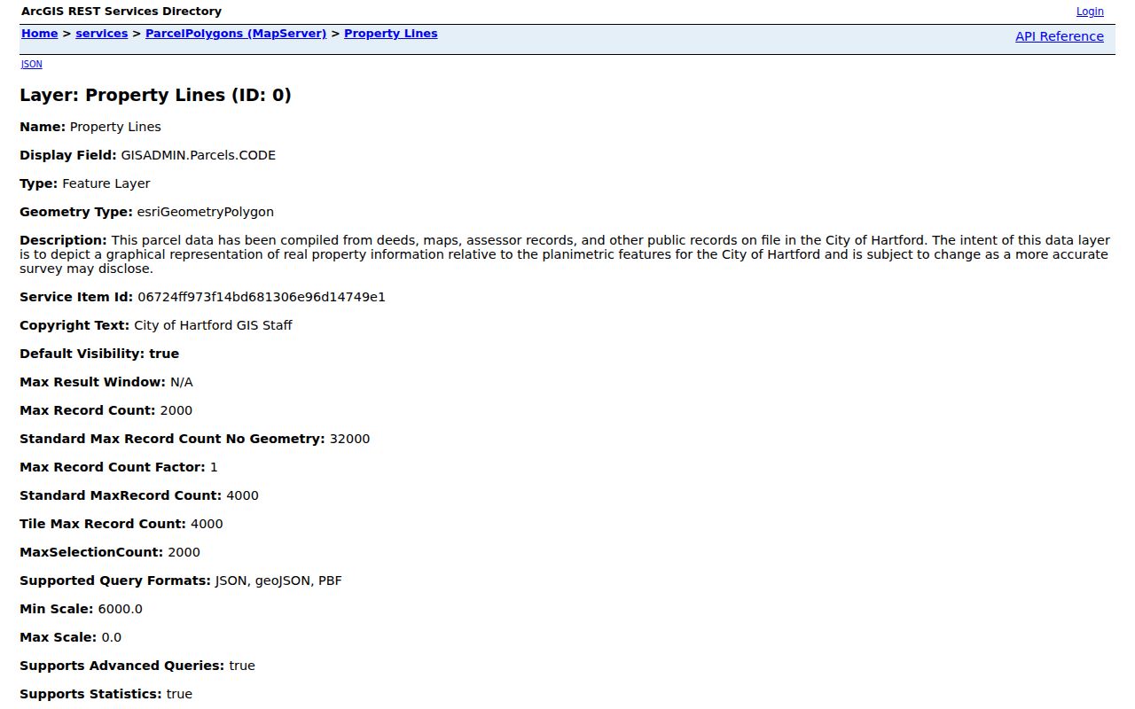
REST queries support narrowing, ordering, statistics, and pagination, with a maximum record count of 2,000. Use them for a bounded street segment or field check. A map line is graphical and subject to survey or data updates.
| Search field | Street use |
|---|---|
| Parcel Number / GIS PIN | Joins the viewer, tax card, map, deed, and plan references. |
| Address | Finds the physical situs; normalize suffixes, directions, ranges, and units. |
| Owner Name | Finds the assessed owner, including a trust, estate, or company when listed. |
| MailingAddress1 / Zip10 | Shows where correspondence goes, not necessarily where the parcel sits. |
| LastGrantor / LegalRef | Starts a deed-chain and map-plan search. |
Hartford Street Address Fields
Situs means the parcel’s physical location. Mailing address means the destination for tax or owner correspondence. The two fields can diverge when an owner uses another home, a business address, a fiduciary, a PO box, or an address outside Hartford. That distinction is one of the most important street-directory checks because a mailing city can look like a second residence when it is only an administrative contact.
A street-by-street record should therefore preserve both fields. Compare the situs with the GIS polygon, parcel number, and tax-map reference. Compare the mailing address with the deed party and role. A property card may show multiple living units or a number range; that is a signal to look for a condo card, unit identifier, plan, or separate parcel, not a count of current households.
- Situs
- The physical property location used by the map, assessor, tax, and permit systems.
- Mailing address
- The correspondence field attached to the assessed owner or account.
- Parcel
- A mapped tax or land unit with an identifier, even when several units share a building.
- Plat or plan
- A recorded drawing or legal reference that can explain lots, subdivisions, easements, or unit changes.
Use this split when a ZIP or city label seems surprising. The physical parcel, not the postal label alone, should control a Hartford address chain.
Hartford Street GIS Walk
HartfordGIS supports a map-first street walk. The interactive catalog includes parcels, address points, planimetrics, zoning, flood, historic districts, tax maps, building permits, scanned documents, planning, and inspector views. Each layer answers a different question. A parcel popup can take a researcher to owner, mailing, legal, and sale fields. A permit layer can show a project or inspection date. A planning layer can explain why two touching properties sit in different civic areas.
Click the target polygon, then pan to the polygons that touch it. Record only the fields needed for the research question: parcel ID, situs, owner or mailing field, land use, zoning, and legal or tax-map reference. For a larger notification-style area, the Abutters List Viewer uses a user-defined buffer in feet. A buffer is a distance calculation, not an official definition of a block or a relationship between nearby people.
The city also publishes more than 60 GIS datasets in formats that include shapefile, KML, spreadsheets, and APIs. Narrow the request to a street or parcel. It is easier to explain a small, dated query than an unbounded city export.
Hartford Address-Keyed Record Coverage
A Hartford street directory is assembled from address-keyed sources with different custodians. The table below separates what can be searched, what the record means, and where the fallback lies. The same address may appear in several rows without producing the same person or date.
| Record set | Custodian | Street clue | Access |
|---|---|---|---|
| Property / tax record | Hartford Assessor and Tax Collector | Owner, parcel, situs, mailing, bill or list number | Viewer, tax page, office |
| GIS parcel layer | Hartford GIS | Adjacent polygons, address points, zoning, tax map | Map, REST, open data |
| Deed index | Town and City Clerk / SearchIQS | Grantor, grantee, instrument, book/page, legal reference | Guest index, image or clerk |
| Permit / 311 request | Development Services / Hartford 311 | Project, inspection, service request, date, status | Public lookup or request |
| Historical directory | HPL, CSL, CHS, FamilySearch | Dated occupant, business, household, street or house number | Scan, shelf, microfilm, reference |
The parcel ID is often the best join key for current work. The legal description is safer than a street number when a parcel split, condo conversion, or name change interrupts the chain. For an older address, a reverse directory can supply the occupant before the name-first directory or deed search begins.
Hartford Street Parcel Card
A parcel result is easiest to use when the fields are read in groups. Identity fields locate the card. Situs fields locate the physical land. Mailing fields point to correspondence. Transaction fields suggest the last transfer. Physical fields describe the improvement. A street directory entry that mixes those groups can make an owner look like a resident or a business address look like a home.
Check StreetNumberFrom and StreetNumberTo when a parcel covers a range. Look for CondoNumber when a building holds multiple cards. Compare OwnerFullName with LastGrantor and LastSaleDate, then open the deed index instead of treating the last sale as a complete title chain. LivingUnits, YearBuilt, and building area describe the property; they do not prove who occupies each unit.
Assessment data also has a date. Hartford’s assessor page cites October 1 as the assessment date, a 2021 revaluation, and a next scheduled revaluation in 2026. An assessment can lag a move or a sale. Use it as a current property lead, then confirm the record date and role elsewhere.
Hartford Street Deed Search
The Hartford land-record index is party-centered. Search the current assessed owner as grantee near the last-sale date, open the purchase deed if an image is present, and capture the grantor, grantee, recording date, book/page or instrument number, consideration if shown, legal description, plan reference, and image status. Then search the grantor as grantee in an earlier period. Repeat until the online coverage ends.
SearchIQS help documents Party 1, Party 2, an ignore-party-type option, from and through dates, document group, document description, town, book/page, instrument number, and case number. Names can be partial or wildcarded in the generic instructions. Hartford’s advanced form was session-gated during inspection, so exact local dropdown labels should be verified live. An index-only result from January 1964 through December 2001 may need a clerk request for an image or paper copy.
Land maps reach back to August 1, 1863. Use a map or plan to bridge a lot that changed street number, and remember that a mortgage party, attorney, fiduciary, or mailing recipient is not automatically the owner or resident. The chain is a research lead, not a title opinion.
Hartford Street Permits and 311
Hartford Accela property lookup has Address, Parcel Information, Owner, Record Information, and Licensed Professional modes. The address form includes street number portions, street name, street type, unit, city, state, and ZIP. A permit record may identify an applicant, owner, licensed professional, description, date, inspection milestone, or status. It is evidence of a project or filing, not a list of everyone using the address.
Hartford 311 provides phrase or keyword search and address-dependent service records. Zoning-violation requests, pothole or sidewalk complaints, dumping reports, and similar entries may be pending, redacted, or non-adjudicative. Read the status and request date. Do not convert a complaint into a finding or a person’s presence into a household claim.
Planning and Development Services are the fallback when a public form changes or returns a gap. Ask for the record type, address, date range, and any public status field. A written FOI request can seek a nonexempt log or segregable record, but it cannot force disclosure of a protected personal field.
Hartford Voter Search Is Not a Street Roster
Connecticut voter records are a named-person verification route. Hartford does not publish an open web browse of every voter on a street. The statewide file request costs $300 and carries current privacy and lawful-use terms. Public fields can include name, former name, residence, former residence, voting district, party affiliation, status, polling place, and participation indicators, while the public DOB release is limited to the year under current guidance.
The state lookup page was rejected by an anti-bot control during inspection, so exact result fields should be confirmed at the source. Hartford registrars can answer polling, canvass, update, and correction questions at City Hall. A registration record can be outdated or protected. It also says nothing about unregistered people, household members, mail recipients, or utility customers.
The official Connecticut voter lookup illustrates the named-person route when an address question becomes a person check.
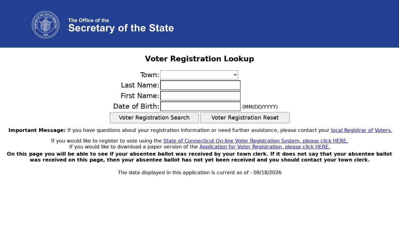
The form supports a dated registration check, not an open street roster. Keep the result date and privacy limits in the research note.
A 2026 TotalVote release reported GIS testing that found district-assignment updates and small sliver districts. A street’s polling geography can change as the state improves its map data. Preserve the search date and current election page when making a civic record note.
When the research goal shifts from a whole street to one person, use the Hartford resident lookup workflow instead of assembling an unsupported street list.
Hartford Reverse Directories by House
Older Hartford street work often starts with the address, not a name. Gardner’s 1840 directory used a directional street guide and printed “h” before a home address in many entries. The first address in a line can be a business or store; the home shorthand is the part that answers the residence question. A widow, boarding house, or two-address entry is a clue about the record, not a full list of occupants.
Library of Congress guidance describes reverse or criss-cross directories as street-first books arranged by street and number. National holdings cover many metropolitan years from 1930-2005, but Hartford volume availability must be checked item by item. Hartford Public Library, the State Library, and the Connecticut Historical Society can identify a city, suburban, telephone, house, or reverse volume. Search both Hartford and former neighboring labels when an old directory includes East or West Hartford.
The Connecticut Historical Society also notes a separate “Colored Persons” section in Geer directories from 1843-1867/8. A broad alphabetical search can miss that separate list. Preserve the scan’s historical wording as source metadata, then verify the person with census, vital, church, newspaper, or deed evidence. The full historical shelf belongs on the city directories page.
Hartford Street ZIP Labels
Postal geography can help narrow a street search but cannot decide whether a parcel lies in Hartford. USPS grouping material places standard, station, unique, PO-box, and institutional ZIPs under Hartford labels. Codes associated with East Hartford or Wethersfield can appear in the same routing context. Hartford neighborhoods also cross ZIP edges, and ZIPs do not match NRZ, census, zoning, or parcel boundaries.
Use USPS by Address for a final street, city, state, and ZIP check. Compare it with the GIS situs, mailing `Zip10`, tax-map reference, and municipal boundary. A mailing ZIP attached to an owner is not proof that the physical parcel, much less a person, sits in that ZIP. The ZIP Directory has the detailed 061xx coverage table and special-use cautions.
Hartford Street Records Fallback
Hartford’s records access map includes an offline path for nearly every major street question. The Assessor can explain an assessment or parcel field. The Town and City Clerk can address an unscanned land image and mail-request process. Planning can clarify an Accela record. Hartford 311 can identify a service-request route. HPL and the State Library can search microfilm, directories, maps, town documents, or historical court and probate material. A courthouse or probate clerk can explain a case-file limit.
Lawful use. A Hartford street directory is for personal, civic, family-history, and property research. It is not a license to watch, threaten, expose, or harass anyone. Owner fields, voter fields, and old directory entries must be handled with care.
Do not assume a missing name means an empty address. An unlisted household member may be outside the record, or the person may be a protected voter, an owner with another mailing address, or a historical occupant whose volume has not been digitized. Record the gap, ask the right custodian, and keep the street-by-street chain tied to dates.
Hartford Street Directory Limits
A street directory cannot provide a complete census of current residents. Hartford public property records do not identify every household member, utility customer, delivery recipient, private phone number, email address, or DMV address. Connecticut DMV data is restricted by the federal Driver Privacy Protection Act and CGS §14-10. Protected voters and Address Confidentiality Program participants can be absent by design.
Even a name that appears at a street address needs a role. Owner, grantee, fiduciary, registered agent, applicant, voter, directory occupant, and household member are different categories. A parcel card may be current while a court display is old. A reverse directory may be exact for its year while the house number or street name later changed.
Use the right record for the right claim. A parcel proves a property connection, a deed proves a recorded instrument, a voter lookup proves a registration result, and a directory proves a dated publication entry.
When those distinctions are kept visible, a Hartford street directory becomes a careful address index rather than an overconfident list of people.